Sundial Bridge Accuracy
Sundial Accuracy

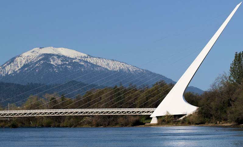
Sundial Bridge over the Sacramento River in Redding, California
The 217 foot high pylon points to geographic north. The pylon is angled at 42 degrees from the vertical (48 degrees from the horizontal) and the length of the pylon is 292 feet. The base of the pylon is located at latitude 40.593, longitude -122.3775. The pylon serves as the gnomon of the sundial. In a typical horizontal sundial, the gnomon's angle from the horizontal equals the latitude, so that the gnomon to parallel to the earth's axis, cf. Sundial Registry
Sundial Bridge Redding CA
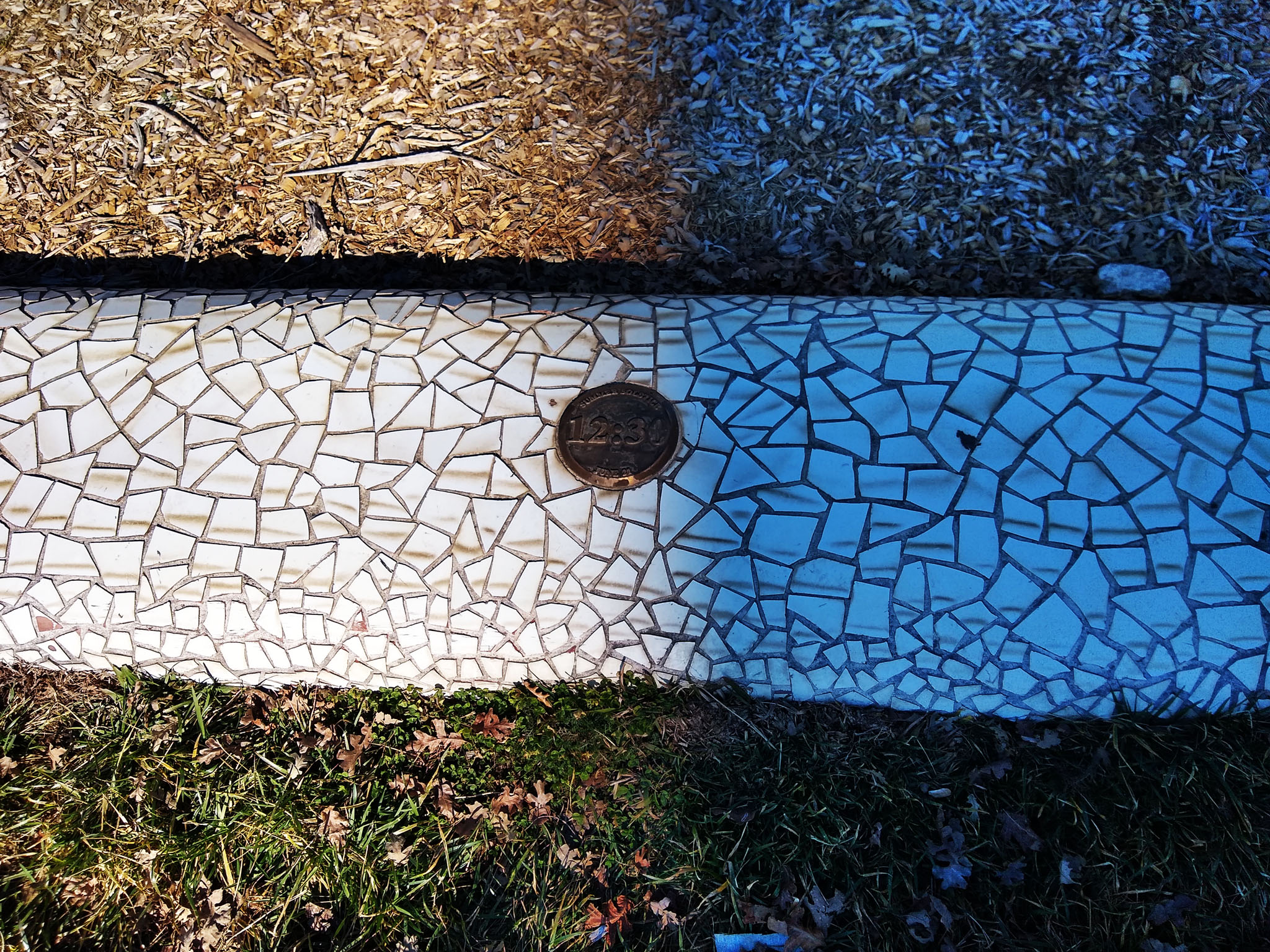
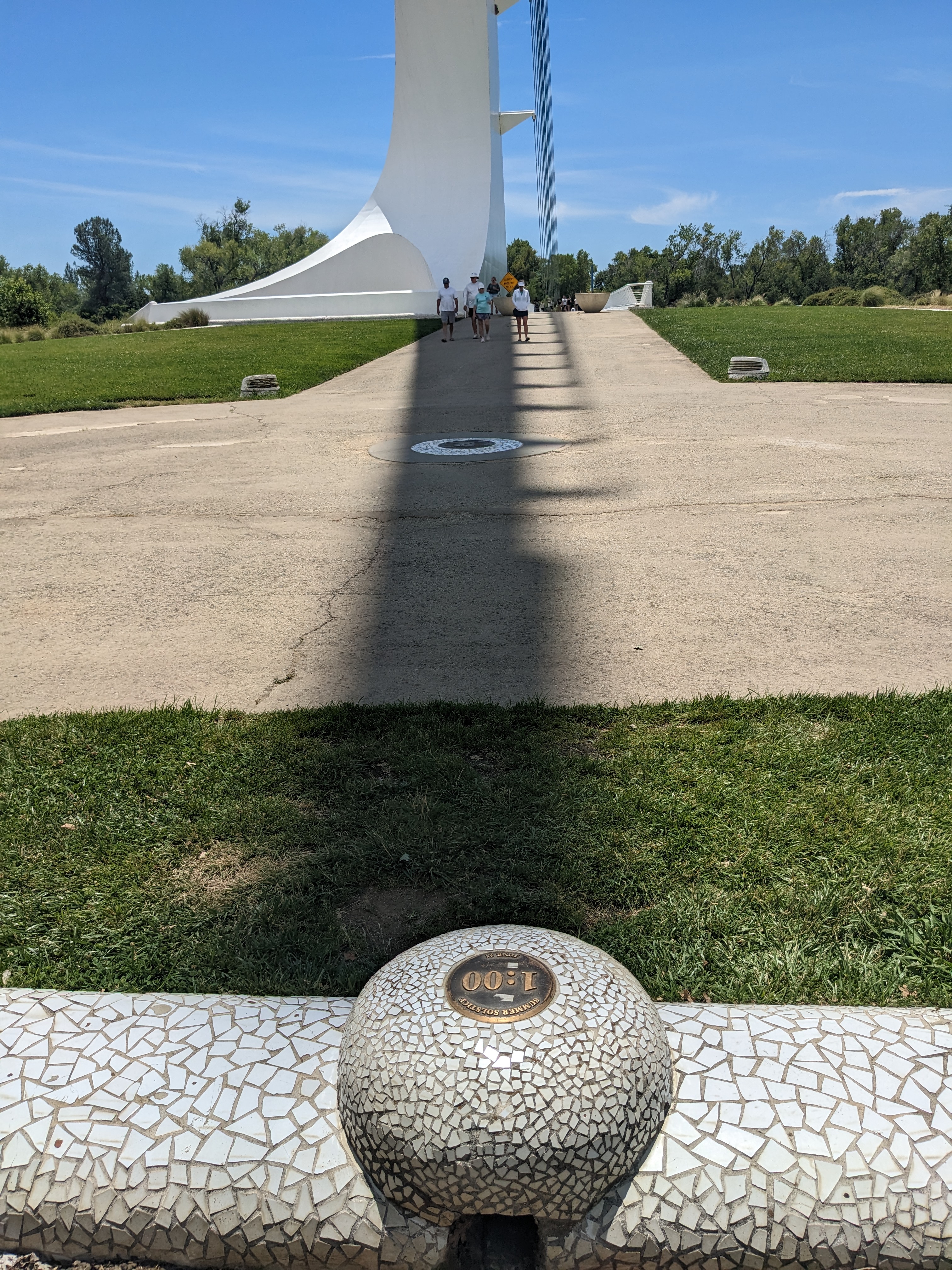
The plaques on the Sundial Bridge use Pacific Daylight Time. The shadow of the pylon points to geographic north at solar noon. The width of its shadow at the plaques is about 3 feet wide in summer and ten feet wide in winter, due to the tapering of the pylon and the sun's elevation being lower in winter, and, of course, the shadow is much longer in winter than in summer. The base of the pylon is about 260 feet from the time plaques, the plaques extend about 225 feet from west to east in an arc and cover the four hour time period from 11 A.M. to 3 P.M. PDT. There are larger plaques for each hour and smaller plaques every 15 minutes. There is no marker for geographic north, solar noon.

With horizontal sundials, the left (west) side of the umbra of the shadow of the gnomon is used to read time until solar noon, and the right (east) side of the umbra is used after solar noon. The Sundial Bridge does not have precise markers, but time can be read with an accuracy of a few minutes in summer or in winter.

The two cell phone photos below were taken on January 22, 2022. Solar noon, on that date and at the bridge's longitude, occurred at 12:21 PST (1:21 PDT), sun elevation at that time 28.8 degrees (NOAA). Right click on the images to enlarge.
Sundial Bridge Redding CA
12:30 PDT plaque, The left side of the shadow reaches the plaque, sundial time 12:31 PDT, cell phone time 11:32:05 PST (12:32:05 PDT). In winter, the shadow extends far beyond the plaques, but sun time is read by using the edge of the shadow.
Sundial Bridge Redding CA
2:00 PDT plaque, the right side of the shadow reaches the plaque,
sundial time 1:59 PDT, cell phone time 1:00:17 PST (2:00:17 PDT).
In both of these photos, sundial time is about one minute before cell phone time.
The next two cell phone photos were taken on June 20, 2023. Solar noon on this date, and at the bridge's longitude, occurred at 1:11:01 PDT, at which time the sun elevation was 72.85 degrees.
Solar noon on the solstice, June 21, occurred at 1:11:14, 13 seconds later than on the 20th (NOAA). Sun's elevation at solar noon unchanged at 72.85 degrees.
At or near the summer solstice the shadow of the gnomon just reaches the plaques.
The timestamp for the Pixel 5A shows UTC.
Sundial Bridge Redding CA
Above is a fact sheet adjacent to the Sundial Bridge. With the angle of the pylon 42 degrees from the vertical, the angle from the horizontal would be 48 degrees, which corresponds with the photo at the top of this page. With its height of 217 feet, the shadow moves 1 foot per minute, one inch every 5 seconds. With a more typical sundial with a height of 17 feet, the shadow moves about one inch a minute, which makes it easier to get an exact time reading.
The 1 million tiles around the plaques break up the shadow of the pylon and make it more difficult to get a precise time reading.
Sundial Bridge Redding CA
Above is a photo of the 1:00 marker plaque, taken on 6/20/23 at 1:00:10 PDT.
The left side of the shadow (as you are facing north) is aligned with the center of the plaque,
so sundial time and cell phone time agree within a minute.

Summary: Time measurements on the Sundial Bridge are accurate in the middle of the day,
within a minute in January and the day before the summer solstice.


Creative Commons License
Robert Karis
www.sfog.us
Alphabetical index
Extreme sundials
Geographic north
Ingleside Terraces Sundial
Ingleside Terraces Sundial accuracy
Sundial factoids
Sundial plaques
Winter solstice